This is an archived website, available until June 2027. We hope it will inspire people to continue to care for and protect the South West Peak area and other landscapes. Although the South West Peak Landscape Partnership ended in June 2022, the area is within the Peak District National Park. Enquiries can be made to customer.service@peakdistrict.gov.uk
The 5-year South West Peak Landscape Partnership, 2017-2022, was funded by the National Lottery Heritage Fund.
The Past beneath our Feet: the Lost Industries of Quarnford
Posted on 4 October 2018
The latest in a series of blog posts chronicling the adventures of our Cultural Heritage Officer; Dr. Catherine Parker Heath. In this installment she recounts a fascinating walk that the South West Peak Landscape Partnership recently held:
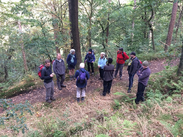
On Saturday 29th September I joined Margaret Black and Eric Wood, two South West Peak volunteers, alongside other enthusiastic walkers and history lovers for a trek around Gradbach. The walk, ‘The Past beneath our Feet: the Lost Industries of Quarnford’, was part of the South West Peak Landscape Partnership’s Small Heritage Adoption Project, intended to share knowledge about the history and archaeology of the area. It was approximately 4 miles long and was planned to take from 10:30am until 3:30pm with a stop for coffee and then lunch.
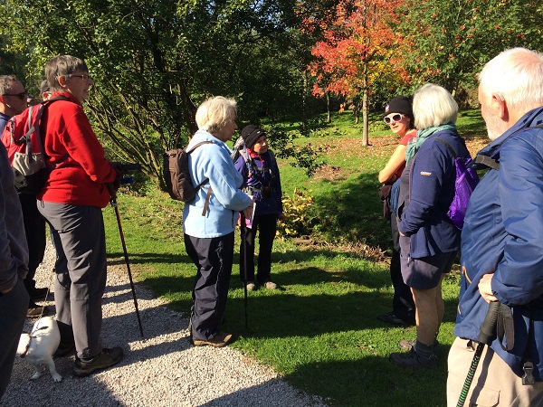
We met at Gradbach car park, and after introducing myself, the South West Peak Landscape Partnership Scheme and the projects I’m involved with (Barns and Buildings and Small Heritage Adoption), I introduced Margaret and Eric. If you have never met Margaret and Eric, they are two of our wonderful and well-informed volunteers (we have plenty more where they came from, and if you’ve not already signed up you could become one too – just go here) and they have spent many years discovering and researching the lost heritage of the South West Peak, from surveying the lime kilns of the area to working on many a project with John Barnatt who, before his retirement, was Senior Survey Archaeologist for the Peak District National Park. Eric has also written a book on the area (Wood, E. 2007 The South West Peak: History of the Landscape, Ashbourne: Landmark Publishing).
A challenge as you read on is to count the number of ‘lost’ industries once thriving in the area…
The walk began in earnest when we were told how the car park at Gradbach has not, unsurprisingly, always been a car park but, perhaps more surprisingly, was once the site of a forge, overlooking the River Dane. Walking on towards the Gradbach Mill, we stopped near the recently refurbished and renovated gateway, drive and walls to consider the site of the old mill pond and where stables were once located. We were told by Eric that the location of the stables, now almost indistinguishable in the field, were once very noticeable by the pattern of growth of nettles there. Nettles can be a dead giveaway for lost sites where there was once a concentration of animal or human waste in the past.
We looked at the old trough, once so important for the pack horses transporting goods in and out of the area, and we were told how not long ago you could walk up the leat (millrace, millstream) to the site of the millpond, but which is now all overgrown and impassable. We considered how clearing the leat and repairing the steps that you could once use to access it could be a Small Heritage Adoption Project. There was some enthusiasm for this and I will certainly consider it.
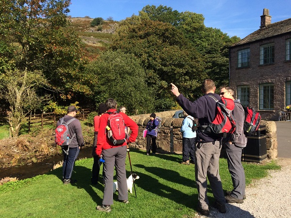
We then had a good look at the mill building itself as Margaret told us of its history. It was built in the late 1700s as a cotton, wool or silk weaving mill but the owners, realising they had not budgeted for the expensive equipment needed for this venture, had to quickly find something else to do with it and so after declaring bankruptcy for the first time, struggled on and turned to linen. When I hear about mills of the 18th century and how many of them fell into trouble soon after opening, I am reminded of the dot.com era where everyone wanted to try and make their fortune and invest in the latest money spinning craze (whether water mills or internet companies), soon realising it is not quite as easy as it may have first seemed. Margaret told us how the water flowing back into the river from the leat after turning the wheel, would often back up, so the river bottom was scoured to deepen it – quite an undertaking. We were also told about the remains of workers cottages on the opposite side of the river, known as Dublin or Doublers Cottages (marked Dublin on the 1879 OS map), which we were not able to see, but a picture showed substantial footings and few courses remaining. These would’ve housed workers brought especially from Ireland because of their specialist skills working with linen, to work in Gradbach Mill.
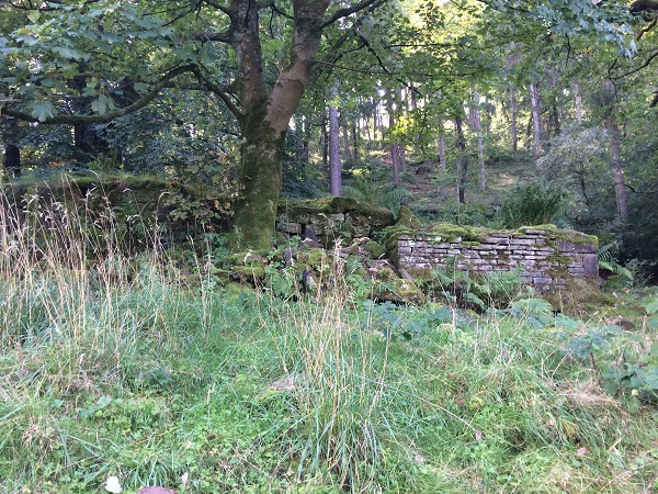
After a brief stop for coffee and to look at some photographs, we carried on along the footpath to Castor’s Bridge. Margaret stood atop a mound which may have looked like a natural feature to many there. Asked to look more closely at the footpath, we noticed there was evidence of slag - the remains of iron smelting and learned that Margaret was in fact standing upon a large grassed-over slag heap. After exploration of the area, we soon realised there were many such mounds in the vicinity. Margaret told us about speaking with John Barnatt who, after a brief investigation, believed these ‘smelting’ sites to be no later than 1600. Margaret and Eric then investigated further and after searching the Historic Environment Record found a record relating to Castor’s Bridge that mentioned ironworking that may have been associated with Dieulacres Abbey and therefore Medieval in date. The HER record, accessible here, although mentioning ironworking in relation to Castor’s Bridge, gives no indication of the extent of the site. There is also the remains of an old building close by, that was still standing in the 1950s. Going by the style of the windows only just visible in an old photograph it may well have been built in the 17th century.
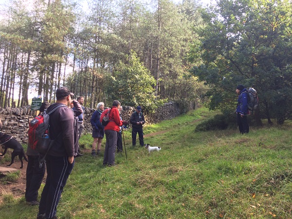
Whenever iron smelting was taking place here, charcoal would have been needed to burn in the kilns to extract the iron from the iron ore, as wood did not enable the kiln to reach a high enough temperature. After lunch we carried on up the path to the site of a charcoal kiln platform. Barely recognisable, we were told how charcoal was created and a little of the life of the itinerant charcoal burners. We learned how the trees that exist there today are not those that would have been there in the past. The conifers were planted in the late 1700s by the Swythamley Estate and the rest is re-growth of native species since then. We were also told by two of the walkers who are involved with Gradbach Scout Camp that most of the trees on their side of Black Brook were felled during the Second World War, and what we see there today is re-growth since then. Some trees, however, thankfully, escaped this felling, and Margaret showed us a picture of a coppiced oak tree on the Scouts’ side. There may be more. There would certainly have been, on both sides of the brook, during the time when iron production was in full swing to provide much needed hard wood for charcoal production.
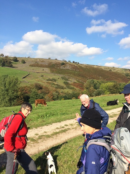
Following this, we made our way along the path to the Gradbach Scout Camp. Along the way, we stopped to look across the valley towards a pattern of walls which bounded the small enclosures where tenterhooks for stretching and drying out the linen made at Gradbach Mill were positioned. Once at the Scout Camp, we looked at the buildings and were asked to guess what the interesting hole high in the side of a building was. Currently it is associated with an extractor fan, I believe (although I may have misheard the conversation), but it used to be for hens. The hens were supposed to have been trained to walk up a ladder to go through the hole to bed each night! The building is what we can describe as a ‘poultigerry’ (this is an official term!) – hens in the top half and pigs in the bottom. We also spent more time than we should considering the development of the house itself, now accommodation for visiting Scouts and Cubs. There is more here than first meets the eye, with at least 3 phases of building if not more. After being told that a ship’s beam has been used inside, I had to relate what I had been told at a recent Understanding Historic Buildings course run by Historic England, and have learnt from further research, that ships’ beams are rarely used in buildings and even more rarely in buildings far from sea ports. It almost certainly had a previous use though, as very strong beams of wood were often re-used, and likely having holes from previous uses, giving rise to the idea they came from ships. What I really needed was to get inside, have a look and take some photos – but that has to wait for another time, as we were then ushered on and took a path towards Green Sytch Farm.
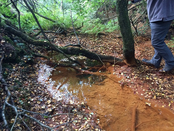
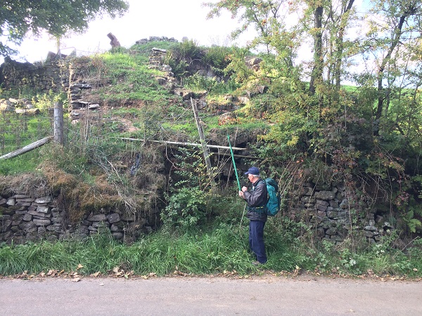
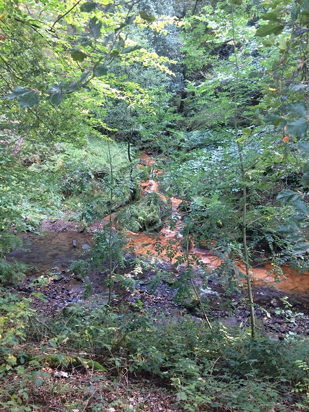
Beyond Green Sytch Farm is Goldsitch Moss, the site of coal-mining probably from the medieval period. After mining began, it was soon realised that a fault was causing water to collect, preventing the miners from digging very far down. To counteract this problem, a sough was built – an underground channel, that drained the water from the mines into a small side stream, called the Gold Sytch. We took a short detour off the footpath to see where the sough emptied out. As well as draining the water the sough also brought with it iron oxide, making what is known as ochre. There was a collection of ochre as the water bubbled out of the sough but then it was carried further on downstream and into the Flash Brook, a tributary or the Dane itself.
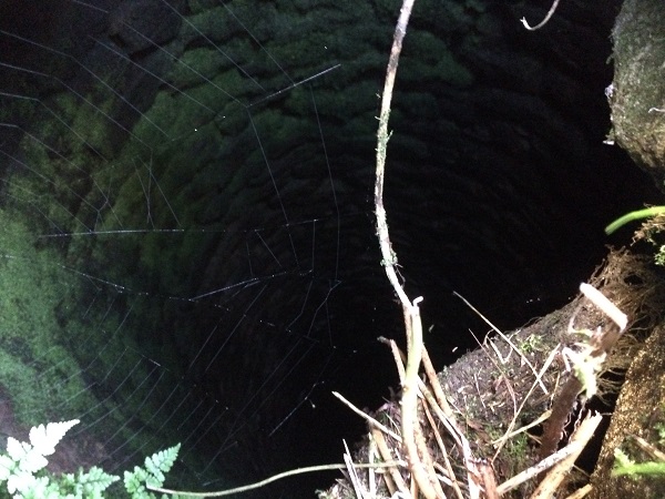
After this detour we carried along the footpath and saw two of the shafts down to the sough. Beautifully stone lined they would have been used to create the sough itself and allow inspection and to keep it clear as time went on. We put a torch down into one through a gap in the well-secured cap stone (to stop walkers and animals from falling in).
We then joined a road, an old turnpike road (dated 1773) and the small toll house that went with it, opposite Bradley Howell (John Bradley’s Hovel) dating to 1832 according to the Historic Environment Record. We turned north to walk down the road passing an earlier toll house (1742) called Tollhouse Cottage and after turning south west onto the main road from Flash to Gradbach we came across a disused lime kiln.
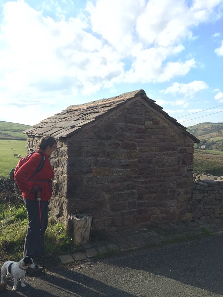
It is in quite a sorry state now, but would have once stood proud by the road side. This may be another contender for the Small Heritage Adoption Project. Two of the walkers with us had even built a lime kiln quite recently but said nothing quite as big as this one.
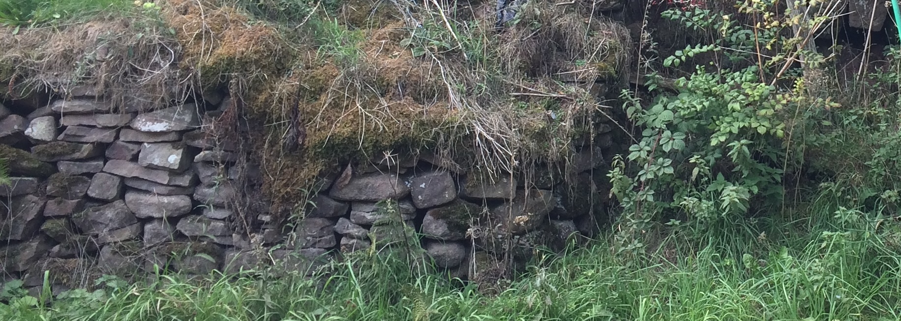
Turning on to the road back toward the carpark, we stopped to look where the tributary the Gold Sytch joined the Flash Brook bringing with it the ochre collected on the way. If you look very closely you can just make out a lower wall and an upper wall and perpendicular to these are cross walls. It is very overgrown now. Described incorrectly on the Staffordshire Historic Environment Record as a mill pond they are in fact ochre settling ‘tanks’, where ochre was collected and then sold beyond the area for pigment.
It was then on to the carpark where we began and the walk ended. We were in fact an hour later than anticipated but this was due to the amount of conversation and discussion about the sites we had seen and the knowledge we had gained from Margaret and Eric. The participants were very happy and many positive comments were made. And the sun shone all day!
In terms of the number of industries how many did you count? I counted 9!
1-Iron forging
2-Silk weaving
3-Flax and linen weaving
4-Iron smelting
5-Charcoal burning
6-Agriculture
7-Coal-mining
8-Lime production
9-Ochre production
Other posts you might like...

© 2021 South West Peak